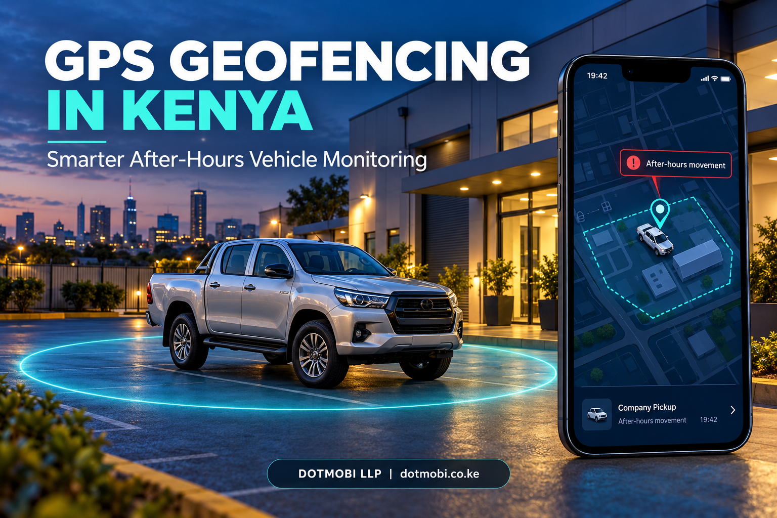
GPS geofencing in Kenya can help vehicle owners and fleet managers identify unexpected movement beyond an approved area. Instead of repeatedly checking a tracking map, you can configure supported systems to flag events that need attention.
Imagine a company pickup parked at the office at the end of the working day. At 10:15 pm, it leaves the premises. Is the driver responding to an approved emergency, taking an unauthorised trip, or moving the vehicle for another reason?
A location pin shows where the vehicle is. A properly configured geofence, working-hours rule, and response procedure help you decide what to check next.
For businesses operating cars, motorcycles, vans, and pickups, this turns tracking information into practical supervision.
What Is GPS Geofencing in Kenya?
A geofence is a virtual boundary drawn around a real location on a tracking platform. It can surround a parking compound, depot, customer site, or another approved operating area.
Depending on the system, entering or leaving that boundary can generate an event or notification.
Geotab’s technical article, An overview of geofencing and routing in MyGeotab, defines a geofence as:
“a virtual perimeter or a fence around a geographical real-world area of interest.”
The article explains how zones can work with exception reporting and notifications to highlight relevant fleet activity. This provides a documented technical basis for using boundaries as part of vehicle supervision.
Source: Geotab — Geofencing and routing in MyGeotab.
A geofence is an alerting tool. It does not physically prevent a vehicle from leaving an area.
Why Look Beyond the Vehicle’s Current Location?
A map becomes more useful when the vehicle’s movement is compared with an agreed operating plan.
For example, a manager may need to know:
- Did the vehicle leave its approved overnight parking area?
- Was the trip outside authorised working hours?
- Was an exception approved?
- Who received the notification?
- What happened after the alert?
These questions are relevant to sales fleets, delivery businesses, institutions, rental operators, and owners who leave vehicles parked for extended periods.
The following seven checks provide a practical starting point.
1. Define the Correct Parking Boundary
Start with a clearly identified parking location. A business depot, office compound, or approved overnight parking area is easier to supervise when everyone understands its boundaries.
Avoid drawing a fence so tightly that normal positioning variation creates repeated alerts. Equally, an excessively large boundary may allow a vehicle to travel some distance before an exit is recorded.
During setup:
- Include the actual parking spaces and normal access area.
- Check whether nearby public roads fall inside the boundary.
- Test a genuine departure and return.
- Adjust the boundary after reviewing the results.
The objective is a useful alert that reflects meaningful movement.
2. Configure Working Hours for GPS Geofencing in Kenya
An exit at midday may be routine. The same exit late at night may require immediate verification.
Ask whether your tracking platform supports scheduled rules or a combination of location and working-hours conditions.
Geotab’s work-hours guidance states:
“By implementing custom work hours for rules, you can help limit unauthorized fleet use”
This supports using schedules alongside vehicle activity rules. Availability on a particular installation depends on the tracking platform and configuration.
Source: Geotab — Customising work hours through rules.
Use the correct local time zone, Africa/Nairobi, and include weekends, public holidays, shift work, and approved overnight assignments in your setup.
A working-hours rule should reflect how your business operates.
3. Record Approved After-Hours Trips
An alert identifies an event for review. It does not establish that someone has misused the vehicle.
A driver may be making an authorised delivery, attending an emergency, or returning late from a customer visit.
Keep a simple approval record containing:
- Vehicle: Company pickup 02.
- Approved driver: Assigned staff member.
- Purpose: Emergency customer support.
- Approved period: 7:00 pm–11:00 pm.
- Destination: Customer premises.
- Authorised by: Operations manager.
When an alert arrives, compare it with the approval record before drawing conclusions.
This makes tracking more useful for accountability and reduces unnecessary disputes.
4. Distinguish Boundary Exits from Parked-Vehicle Movement
Geofence exit detection and towing detection serve different purposes.
A geofence event concerns crossing a location boundary. Towing detection, where supported, may use movement sensors and ignition conditions to identify unexpected movement while parked.
Teltonika’s FMC650 documentation describes towing detection as a feature that can identify a vehicle being towed or lifted. Its operation depends on configured ignition, activation, acceleration, angle, and duration conditions.
Source: Teltonika — FMC650 accelerometer features and towing detection.
Before purchasing or configuring a tracker, ask:
- Does this specific model support parked-movement or towing detection?
- Is the feature enabled?
- Which conditions trigger it?
- How is the event delivered to the owner?
Do not assume every GPS tracker includes the same functions.
5. Test the Complete Notification Process
A correctly recorded event is useful only if the responsible person receives and understands it.
Conduct a supervised test before relying on the installation:
- Park inside the approved boundary.
- Activate the relevant rule.
- Move the vehicle outside the boundary safely.
- Confirm that the platform records the event.
- Confirm that the intended recipient receives the notification.
- Check the event time, vehicle identity, and location.
Ask the installer to explain reporting intervals, mobile connectivity requirements, notification channels, and what happens during a connection interruption.
Do not assume every alert will arrive instantly. Test the actual installation under realistic conditions.
6. Assign Someone to Respond
Every important alert needs a named recipient and a clear next action.
A practical response procedure is to:
- Check the event time and latest available location.
- Review any approved trip.
- Contact the assigned driver.
- Escalate unexplained movement through the company’s security procedure.
- Record the outcome.
Avoid confronting suspected thieves or attempting an unsafe interception. Where criminal activity is suspected, involve the appropriate authorities.
Geofencing can support earlier awareness, but response arrangements determine how useful that awareness becomes.
7. Review Alerts and Improve the Rules
Review your first month of alerts before deciding whether the setup is effective.
Useful measures include:
- Total after-hours departures.
- Departures linked to approved work.
- Events requiring further investigation.
- Repeated unwanted alerts.
- Time taken to acknowledge important notifications.
If legitimate trips repeatedly trigger urgent alerts, refine the schedule or approval process. If departures are missed, review the boundary, reporting settings, connectivity, and device operation with your provider.
Tell authorised drivers how business vehicle monitoring works, and restrict access to tracking information to people who need it.
A Practical Kenyan Fleet Example
Consider a Nairobi business with three service pickups. Vehicles normally return to the depot by 6:30 pm, although technicians sometimes attend evening call-outs.
An illustrative setup could include:
- A geofence around the depot.
- An after-hours monitoring period beginning at 7:00 pm.
- A written approval process for evening assignments.
- Notifications to the operations manager and a backup contact.
- A weekly review of unexplained departures.
If a pickup leaves at 9:20 pm, the manager checks the approved call-out list and contacts the driver.
This example illustrates a management process. It is not a claim about measured savings, theft prevention, or guaranteed recovery.
Choosing GPS Geofencing in Kenya: Questions to Ask
Before committing to a tracking package, request a demonstration using your intended operating scenario.
Ask the provider to explain:
- Whether geofencing is included in the proposed package.
- Whether alerts can follow working-hour schedules.
- Which notification channels are available.
- Whether historical events can be reviewed or exported.
- Which additional features require different hardware.
- Installation, subscription, support, and renewal charges.
A demonstrated feature is more useful than a broad promise that a tracker “does everything.”
How Dotmobi Can Help with Vehicle Monitoring
Dotmobi supplies vehicle and motorcycle tracking solutions for individual owners, businesses, and institutions. Its published product information includes location monitoring, route history, movement monitoring, and speed monitoring.
Explore Dotmobi’s GPS motorcycle and vehicle trackers and discuss the specific controls your vehicles require.
For geofencing, scheduled alerts, towing detection, or other advanced functions, request confirmation of the proposed device and platform capabilities before installation.
Visit Dotmobi to discuss a tracking setup suited to your vehicles, parking arrangements, and operating hours.
Frequently Asked Questions About GPS Geofencing in Kenya
Can GPS geofencing stop a vehicle from leaving?
No. Geofencing detects a boundary-related event and may generate a notification. It does not physically restrain the vehicle.
Can a geofence alert prove vehicle misuse?
No. Review the trip approval, driver explanation, and available records before reaching a conclusion.
Does every car tracker support scheduled geofence alerts?
No. Features depend on the tracker, platform, subscription, and configuration. Request a demonstration before buying.
Is towing detection the same as geofencing?
No. Geofencing concerns a location boundary. Towing detection may use movement sensors and ignition conditions, depending on the device.
Is geofencing useful for one vehicle?
Yes, it can help an individual owner monitor departures from an approved parking area, provided the system supports the required rules and notifications.
Research and Technical References
- Geotab: Geofencing and routing in MyGeotab
- Geotab: Customising work hours through rules
- Teltonika: FMC650 accelerometer features and towing detection
These references document technical capabilities. They do not establish a guaranteed reduction in theft or unauthorised use in Kenya.